MyRouteOnline allows you to work with GPS coordinates (latitude, longitude).
Planning with Latitude/Longitude (instead of full address) is convenient in rural areas or when the full address is not available.
Lat-Long in brackets
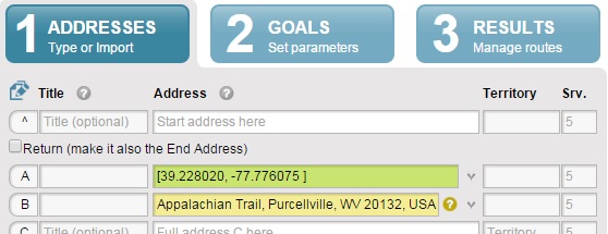
Merely inserting the coordinates without square brackets, as shown in columns A and B, will cause the program to try to find the closest address, which may or may not be correct.
For example, if you put the coordinates [39.228020, -77.776075] in square brackets as shown in line A, the marker is placed at the exact location. If you put the coordinates without square brackets, they are changed to the nearest location Google Maps found, as shown in line B.
GPS coordinates
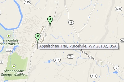
The two different markers on the map show that the two stops are being processed differently by our mapping engine. This is a rural area in Virginia and these coordinates were recognized as Appalachian Trail, Purcellville, WV 20132, USA
Coordinates in brackets
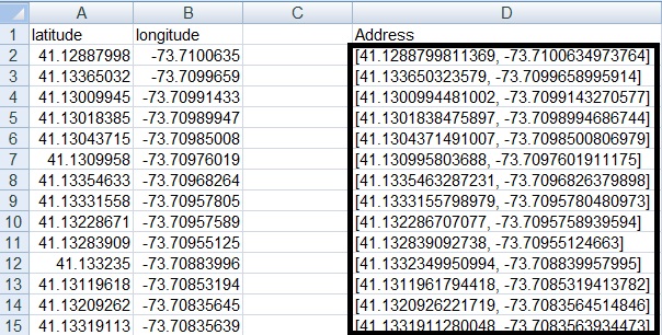
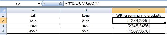
An easy way to add brackets to your coordinates, is using this formula =”[“&A1&”,”&B1&”]”
Lat and Long with brackets
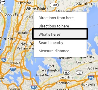
How do I get GPS coordinates from Google Maps?
To get latitude/longitude coordinates using Google Maps:
The addresses that you enter, are being geo-coded and thus change according to locations recognized by Google Maps.

Google Maps coordinates
Coordinates locator
