How to Draw a Route on Google Maps
October 14, 2026
Google Maps can show you a route in three different ways, and the right one depends on what you are trying to do. A short trip with a couple of stops needs nothing more than the Directions panel. A route that follows a path you choose, such as a delivery area or a bike ride, is a job for Google My Maps. And once your list of stops gets long, you need something that also works out the order. Here is how each one works, with the steps and the limits.
The Three Ways to Draw a Route on Google Maps
| Method | Best for | How many stops | Custom path? |
| Google Maps directions | A single trip with a few stops | A starting point plus up to 9 stops, with the last destination counted as one of them | Drag a driving route onto a different road |
| Google My Maps | Your own lines and shapes, maps you can save and share | Lines, shapes and places on layers, up to 10,000 per map | Yes, you place every point yourself |
| A route planner such as MyRouteOnline | Many stops, deliveries, routes you repeat | Up to 1,000 addresses per run | It finds the order for you, and you can still move stops by hand |
Method 1: Draw a Route With Google Maps Directions
Start here when you have one trip and only a few stops. The steps below are for Google Maps in a desktop browser.
- Open Google Maps and go to Directions.
- Type where you are starting and where you are heading. If you want to start somewhere other than your current location, click Your location and change it.
- Use Add destination for each extra stop, entering them in the order you plan to visit.
- Watch the limit: Google allows a starting point plus 9 stops, and your final destination is one of those 9.
- If a stop is in the wrong place, drag it up or down in the list.
- If you would rather take a different road, drag the route line to the road you want. This works for driving routes.
Extra stops are not available when you search for public transit or flights. And because you set the order yourself, Google Maps will follow exactly the sequence you give it.
Method 2: Draw a Custom Route With Google My Maps
Choose this method when the route should follow a path you decide on, for example a delivery area, a walking tour or a cycling loop. Google My Maps is a separate tool from the regular Google Maps app. You sign in with your Google Account, build a map, and then save or share it.
Draw a line by hand
- Sign in to My Maps on a computer, then open a map or start a new one.
- Select Draw a line and choose Add line or shape.
- Pick the layer the line should live on, then click the map to place the first point.
- Click again at each turn or curve so the line follows the path you have in mind. To pan the map while you draw, hold the mouse button down and drag.
- Double-click the last point to end the line.
- Give the line a name and save it.
You can move a finished line or shape by clicking it and dragging it across the map. One map holds up to 10,000 lines, shapes or places, and a single layer holds 2,000.
Add a driving route with directions
- In your map, click the Add directions icon.
- Enter where the route starts and ends. The route is drawn on your map right away.
- Use Add destination to continue the trip with another leg.
- Set the travel mode to Driving, Bicycling or Walking under the layer name.
- To change the path, drag the route on the map to where you want it.
Every set of directions is placed on its own layer, so a single map can hold several routes side by side. For written instructions, click More and then Step-by-step directions.
Method 3: Plan a Route With Many Stops Using a Route Planner
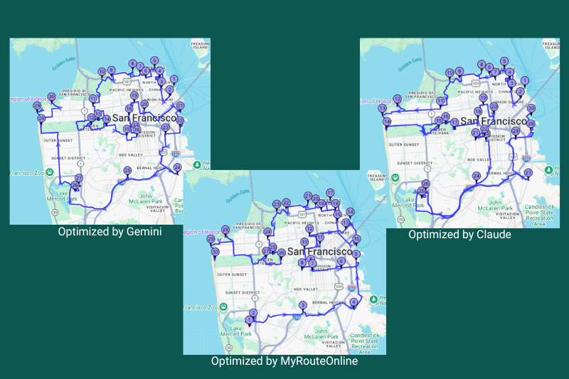
Drawing by hand stops working well when the list of stops is long, or when the order decides how many miles you drive. Even 9 stops can be visited in more than 360,000 different orders, so choosing the best one by eye is guesswork. For a driver who does the same run every day, a poor order costs extra miles every day.
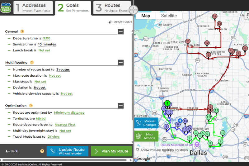
A route planner does that sequencing for you. In MyRouteOnline, the process looks like this:
- Add your addresses. Type them in, paste a list, or import them from Excel, CSV, a text file, Google Drive or Dropbox.
- Pick a goal. Minimize distance, minimize time, or balance the two.
- Optimize. The planner orders up to 1,000 addresses in one run. You can still move stops by hand afterward.
- Send the route out. Open the route in the MyRoute app, which works with the navigation app already on your phone, such as Google Maps or Waze. You can also export the route to Google Maps or email it to your team.
You can also describe your stops to ChatGPT or Claude and let them use the planner for the optimization. See the guides for
Claude and ChatGPT.
Have more than 9 stops? Plan Multi-Stop Route with MyRouteOnline.
Which Method Should You Use?
- One trip with a few stops: Google Maps directions (Method 1).
- A custom path, a map to share, or a route that is not an ordinary road trip: Google My Maps (Method 2).
- Deliveries, service calls, or any route with more than 9 stops: a route planner (Method 3).
- A route you run again and again: a route planner, so you can save it and reload it instead of drawing it each time.
If you already use Google Maps or Waze for navigation, you can keep doing that. Plan and sequence the route in the planner, then send it to your phone with the MyRoute app and open it with Google Maps.
FAQ about Google Maps, My Maps and MyRoute
Can I draw route on Google Maps?
Yes. In Google Maps directions, you can drag a driving route onto a different road. For a fully custom path, use Google My Maps: select Draw a line, choose Add line or shape, and click along the path you want. Double-click to finish.
How many stops can I add in Google Maps?
On a computer, Google Maps allows a starting point plus up to 9 stops, and the final destination counts as one of those 9. Extra stops are not available for public transit or flight searches.
Does Google Maps put my stops in the best order?
Google Maps follows the order you enter, and you can drag stops to rearrange them. If you need the most efficient order for many stops, a route optimization tool works it out for you.
How do I draw a route with more than 9 stops?
You can draw a line by hand in My Maps, or use a route planner. MyRouteOnline orders up to 1,000 addresses in one run and can export the result to Google Maps.
What is the difference between Google Maps and Google My Maps?
Google Maps is for getting directions. My Maps is for building your own maps, with lines, shapes, places and directions saved on layers that you can share.
Can I send a route planned in MyRouteOnline to Google Maps or Waze?
Yes. The MyRoute app works with the navigation app installed on your phone, including Google Maps, Waze and more. You can also email the route to your team.